The EAPCE’25 Post Conference Field Excursion in the Northern Circuit will be conducted for three days from 8th to 10th March 2025. The excursion route will start from the Eyasi Wembere Rift Basin to the Ngorongoro Conservation Area. The delegates will be able to view the Eyasi Wembere Rift Basin, visit Tarangire National Park, view the Gregory Rift, visit the Olduvai Gorge (the locality of the Human Ancestor - Australopithecus boisei), the Shifting Sands, and the famous Ngorongoro Crater.
The trip will also offer an opportunity to view an extensive exposure to the East African Rift System (EARS), one of the world's famous geologic wonders.
DAY 1
Delegates will be picked up at Dodoma Airport and drive to Singida-Sekenke where they will have a clear view of the Sekenke Border Fault, which is the margin of Eyasi Wembere rift basin, and be introduced to Eyasi Wembere basin’s geological setting in the relation to other rift basins, hydrocarbon potentiality and the exploration activities conducted so far in the area.
In the afternoon, delegates will drive with a packed lunch to Burunge Tented Camp in Tarangire for dinner and overnight.
DAY 2:
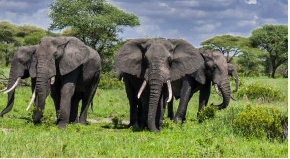
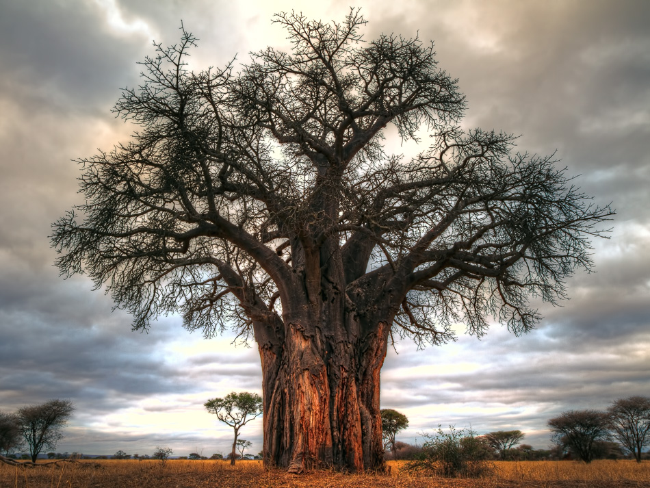
After breakfast, delegates will have a game viewing in Tarangire National Park where they will see the giant baobab trees, different wild animals such as elephants, lions, leopards, cheetahs, antelopes, gazelles, buffaloes, zebras, warthogs, etc.
African Elephants in Tarangire
Giant Baobab trees of the Tarangire
Delegates will have a picnic lunch at the Park, and in the late afternoon, will drive to Country Lodge Karatu in Karatu for dinner and overnight where along the way to Mto wa Mbu they will have a stop view of the Gregory Rift, Manyara Lake, and the exposed Oolitic and fossiliferous Limestone outcrops (Lake Beds).
A close view of the Gregory fault escarpment at Mto wa Mbu area
DAY 3:
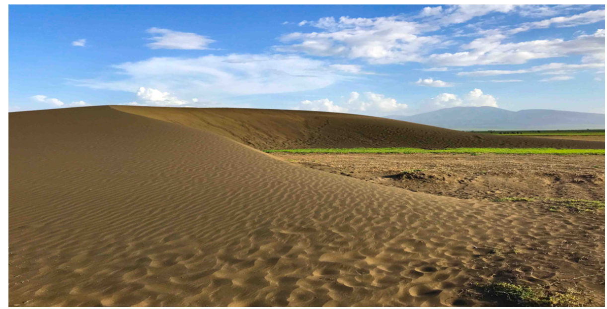
After breakfast, delegates will drive to the Ngorongoro Conservation Area where they will have an opportunity to see the magical shifting sands. These are volcanic sand dunes made of volcanic ash from the active Oldonyo Lengai. This is the one of the most amaizing ash dunes in the world that gradually blown Westward across the planes at the rate of approximately 15-29m annually.
Crescent shaped strongly magnetic shifting sands.
Then delegates will visit Olduvai Gorge, a very important site for anthropological history and understanding of early human evolution. At the site, delegates will see the skull and bones of earlier humankind and the very well-preserved oldest sediment succession ranging from 2.1 Ma to 600,000 years ago.
An area around Olduvai Gorge showing a well preserved sedimentary 1.2 Ma - 600,000 years succession of sedimentary beds.
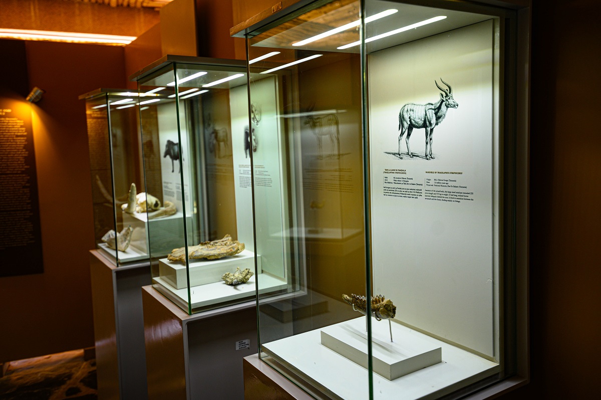
The Olduvai Museum
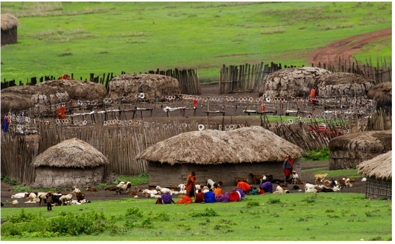
On the way back, delegates will have an experience of cultural aspects of Maasai tribe lifestyles with wild animals and traditional houses at the Maasai Boma area.
Cultural Aspects of Maasai Tribe - Typical Maasai Boma.
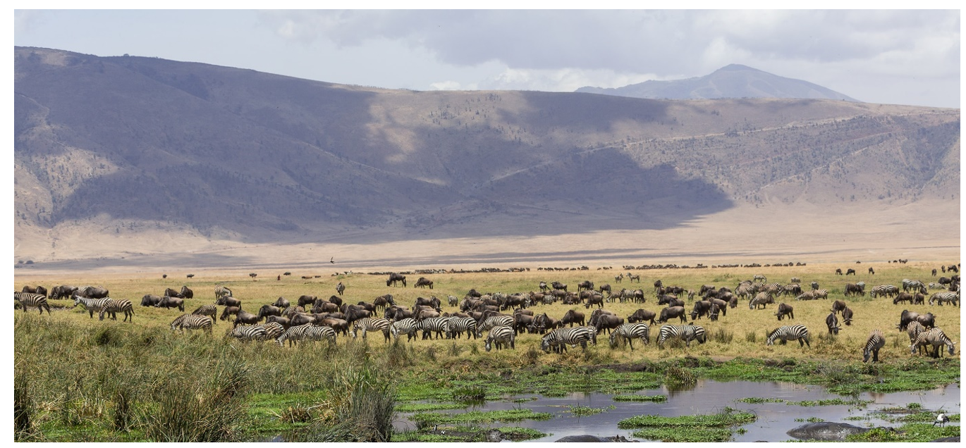
Delegates will then descend to the Ngorongoro Crater that is one of the seven world heritage sites. While in the crater, delegates will have an opportunity to learn its geological evolution and be able to see various wild animals like lions, antelopes, zebras, elephants, buffalo etc. Delegates will also see the Crater Lake with both salt and fresh water.
Delegates will have a picnic lunch inside the Crater near the fresh water Lake then drive outside the Crater along the rim of the Ngorongoro Crater and drive to Arusha for dinner and overnight at Green Mountain Hotel.
A view of Ngorongoro Crater and the lake within as seen from the rim of the crater.
DAY 4: DEPARTURE
Fees: US$ 1,100 per person non–residents, US$ 998 per person for East African residents
Includes meals, transport, accommodation and park entry fees. Final Fees are to be confirmed based on the applicable fees during March 2025.
Contact:
Mr. Partick Kabwe, Petroleum Geologist, Tanzania Petroleum Development Corporation P.O. Box 2774, Dar es Salaam, Tanzania Tel: +255 763 588290 Email: This email address is being protected from spambots. You need JavaScript enabled to view it.
A three (3) day post-conference field excursion to the Southern Albertine graben is planned to take delegates through the Semliki Basin and Lake Edward-George basin, with the magnificent Queen Elizabeth National Park. The field trip will give the delegates the opportunity to observe the spectacular geology of these areas, visit the Sempaya hot springs and enjoy a tour of the Queen Elizabeth National Park.
Queen Elizabeth National Park
DAY 1: GEOLOGY OF SEMLIKI BASIN
Semliki basin is a half graben controlled by Congo master fault. On the Uganda side, a flexural opposing fault system exists. Data that has been acquired by Government of Uganda (gravity and magnetic) and oil companies (seismic and well) show thick sediment accumulations (depocenter) of up to 4km around the southern end of Lake Albert (Ntoroko area). This sediment burial could have generated and migrated hydrocarbons from potential organic rich source rocks into the surrounding structures that have been mapped. The south of the basin is occupied by the Rwenzori mountains which is regarded as the source and/or barrier to sediment escape from Semliki basin. Pickford and Senut (1994) dated surface exposures from this basin to be of Middle Miocene to recent whereas conflicting ages of Early Miocene (Lukaye, 2009) and Early Pliocene (RPS Energy, 2008) have been suggested for the Turaco well sections on the basis of palynomorphs. Subsequent mapping by the Department of Petroleum Exploration and Production indicates that these sediments are fluvial lacustrine deposits that have been grouped into Nyabusosi, Nyakabingo, Nyabugoro, Oluka, Kakara, Kasande and Kisegi Formations based on lithological properties and depositional environment.
Stop 1: Kichwamba observation point and Mungu ni Mukubwa.
Generally, a trip to Semliki has the most marvelous and breath-taking views. You will experience the thrilling meandering Bundibugyo Road through the Rwenzori escarpments. At “Munguna Mukubwa” while in the mountains, the road offers scenic views of the meandering Semliki River, fuming hot springs and the tropical rain forest extending to Ituri forest in the DRC. From this point, you will also enjoy a view of the raised surfaces of relay ramp structures on the other side in the DRC side that resemble the Kaiso Tonya structures of Uganda
Stop 2: Kibuku road cut and oil seep
Kibuku oil seep is located at the nose of Rwenzori mountains. At Kibuku, a characteristic paraffinic odour fills the atmosphere. The oil comes to surface through coarse to conglomeratic sandstone, which appears oil stained. Oil films cover most part of the Kibuku river and/or water pools during the dry seasons. The delegates will have an opportunity to discuss 120-150m good quality channel complexes exposed by the constructed road.
Kibuku oil seep and the road cut
The medium-coarse grained well sorted sandstone demonstrates good reservoir characteristics within this part of the basin. The top most layer shows greenish-grey claystone. Weathered basement and basal conglomerates are other potential rocks.
Stop 3: Sempaya hot springs
The geothermal gradient within the EARS is obviously high as indicated by a vast number of hot springs. The geothermal gradient for the western arm of EARS is estimated at 67 to 73mW/m2. Estimates from Turaco have given 35oC/km. At Sempaya, hot water jets out at various locations resulting into clouds of steam in the area, at 100oC
Sempaya hot spring
Stop 4: Makondo fault
The Makondo fault is a NE-SW trending oblique slip fault dipping to the NW and displaying a transpressional positive flower structures at transfer zones. A horse tail structure is interpreted on Iknois satellite data from Semliki basin corresponding NE termination of Makondo fault.
After stop 4, delegates will drive and spend night in Fort Portal,
Makondo Fault
DAY 2: GEOLOGY OF LAKES EDWARD AND GEROGE BASINS
These basins represent the Southern domain of the Albertine graben and trends in the NNE-SSW being the dominant trend and the NNW-SSE trends being minor. The two sub-basins are generally two opposing half grabens with the major boundary fault on the Congo side, the NNE-SSW trending Lubero Fault controlling the area of maximum subsidence coincident with the present-day location of Lake Edward. Lake Edward is connected to Lake George by Kazinga channel which is believed to be a remnant of an older river that drained westwards.
Delegates will depart from Fort Portal at 7.00am and drive to Lake Edward-George basins.
Stop 5 and 6: Bunyaruguru Crater Lakes
The western arm of the East African rift system is essentially amagmatic. Volcanic provinces are aerially and volumetrically small leaving the majority of the western rift devoid of magmatism. In the Albertine graben, two volcanic provinces of quaternary age have been observed; the Katwe-Kikorongo and Bunyaruguru-Fort Portal provinces. At Bunyaruguru, several crater lakes and volcanic ash are evident.
One of the crater lakes in the basin
One of the crater lakes in the basin The volcanic rocks mainly tuffs and ashes are beautifully exposed in the vicinity of the recent explosion craters as well as along the eastern basin margin faults. Some of the tuffs can be seen in some locations to have been folded by later Neogene compression regime. Delegates will depart for a night in Mweya safari lodge.
DAY 3: GAME DRIE IN QUEEN ELIZABETH NATIONAL PARK (08:00 - 11:00 HRS)
Queen Elizabeth National Park (QENP) covers an area of 770 sq. miles (1995sq.km). Road access from Uganda’s capital city of Kampala is 206 miles (420km). By air, it can be accessed through the landing strip at Mweya Safari Lodge for light aircraft or a larger airstrip at Kasese town. QENP lies in the fertile equatorial area that is especially scenic, with two lakes connected by a channel overlooked by a high peninsula. It also has volcanic craters, grassy plains and tropical forest with high biodiversity rating in the world. Formerly called the Rwenzori National Park, QENP returned to its royal colonial name. The wide bio-diversity contains the most astonishing number of species-almost 100 types of mammal and 606 different birds, with Kazinga channel alone housing the world’s largest concentration of hippos.
Climbing lions in QENP
Other wildlife includes; warthogs, buffaloes, rare aquatic sitatunga antelopes, beautifully horned Uganda kob, giant forest hog, waterbuck, topi, elephant, leopard etc. Kyambura (or Cham-bura) gorge on the northern eastern boundary of the park has thick canopies and vines dangling down to the soft forest floor inhibited by chimpanzees. The Maramagambo forest, south of the Kazinga channel is home to a large number of chimpanzees plus a number of other monkey species.
The pouting shoebill (or whale-headed) stork and myriad of other birds and mammals are best viewed from a boat on Kazinga channel. Specialties at QENP include a beautiful sunset over the water, warthogs and hippos mowing the lawn at the Mweya Safari Lodge, boat ride on Kazinga channel, chimpanzees in Kyambura/Chambura gorge and beautifully positioned safari lodges.
Delegates will set off for Kampala at 11:00Hrs
Fees: US$900 per person.
Costs include transport, accommodation, meals and park fees. Delegates should ensure they carry appropriate field gear e.g. field boots.
Contact:
Tonny Sserubiri Principal Geologist/Exploration Petroleum Exploration, Development and Production Department 21-29 Johnstone Road. P.O. Box 9, Entebbe/Uganda Office: +256 414 320714 Fax: +256 414 320437 Mobile: +256 781163590/703463009 Email: This email address is being protected from spambots. You need JavaScript enabled to view it.
Delegates will depart around 09:00 am from Bujumbura to the Southern source of the Nile about 115km from Bujumbura, in Bururi Province.
Germans Fault of Nyakazu
After visitng the Source of the Nile, delegates will visit the faults of Germans and Karera water falls in Rutana Province.
Karera Waterfalls
After Karera, delegates will then head to Gitega where the distance is about 100km from Bujumbura, the political town of the country which is located in the central region of Burundi, where they will visit two sites: Gitega National Museum and the Traditional drummers at Gishora site.
Delegates will spend the night at Gitega Town.
Fees: US$830 per person.
Cost- will cover local transport, meals, access to Rusizi Park and accommodation.
Contact:
Mr Bigirimana Gérard Ministry of Hydraulics, Energy and Mines Burundian Mines and Quarries Authority P.O. Box 745 Bujumbura, Burundi Tel: + 257 79 981 634 Email: This email address is being protected from spambots. You need JavaScript enabled to view it.
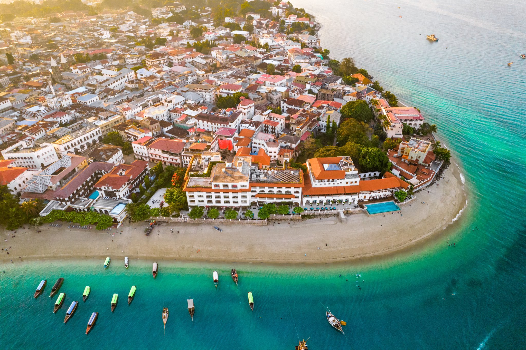
Stone Town is a fine example of the Swahili coastal trading towns of East Africa which is UNESCO World Heritage Site. It retains its urban fabric and townscape virtually intact and contains many buildings that has brought together and homogenized disparate elements of the cultures of Africa, the Arabian, Indian, and Europe over more than a millennium. The tour of the Stone Town will pass through major historic and well known landmarks:
i. The House of Wonders:
Built in 1883 and was the first building to have electricity in Zanzibar and the first in East Africa to use lift.
ii. Old Fort:
Built in 1669 and was originally used as a garrison. It was later used as prison and as the terminal for Zanzibar railway.
iii. Old Slave Market:
The old slave market is now situated at The Anglican cathedral of Christ Church, which was built at the end of the 19th century by Edward Steere, third bishop of Zanzibar. The site contains a monument to the slaves and the museum on the history of slavery.
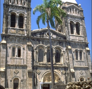
iv. The Roman Catholic Cathedral of St. Joseph:
Built in 1897 by French missionaries with the design based on Marseille Cathedral.
St. Joseph's Cathedral, Zanzibar
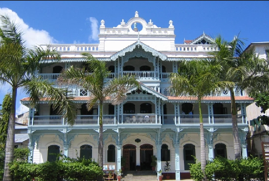
v. The Old Dispensary:
Built in 1894 by a wealthy Indian trader as a charity hospital for the poor. Facing the historic Zanzibar harbor, the old dispensary is one of the most finely decorated buildings of Stone Town with large carved wooden balconies, stained-glass windows, and neo-classical stucco adornments.
The Old Dispensary, Zanzibar
vi. Royal buildings:
Several buildings used by Zanzibar royals are situated at Stone Town including Palace Museum and Sayyeda Selme house.
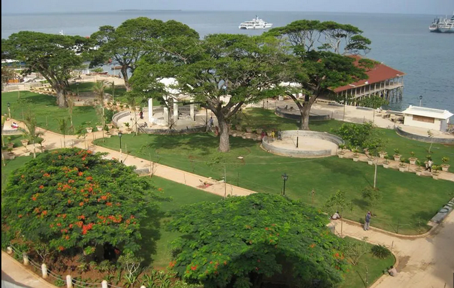
vi. Forodhani Garden Park:
This historic garden is at the sea front in front of major historic buildings and sites. The garden has a “floating” restaurant and a vibrant night life with great choices of local and sea foods.
Forodhani Garden Park, Stone Town
B: Jozani National Park
i. Jozani National Park:
The largest indigenous forest in Zanzibar with unique plants and species. It constitutes groundwater forest, coastal forest, and grassland, with mangroves and salt marsh at the coast.
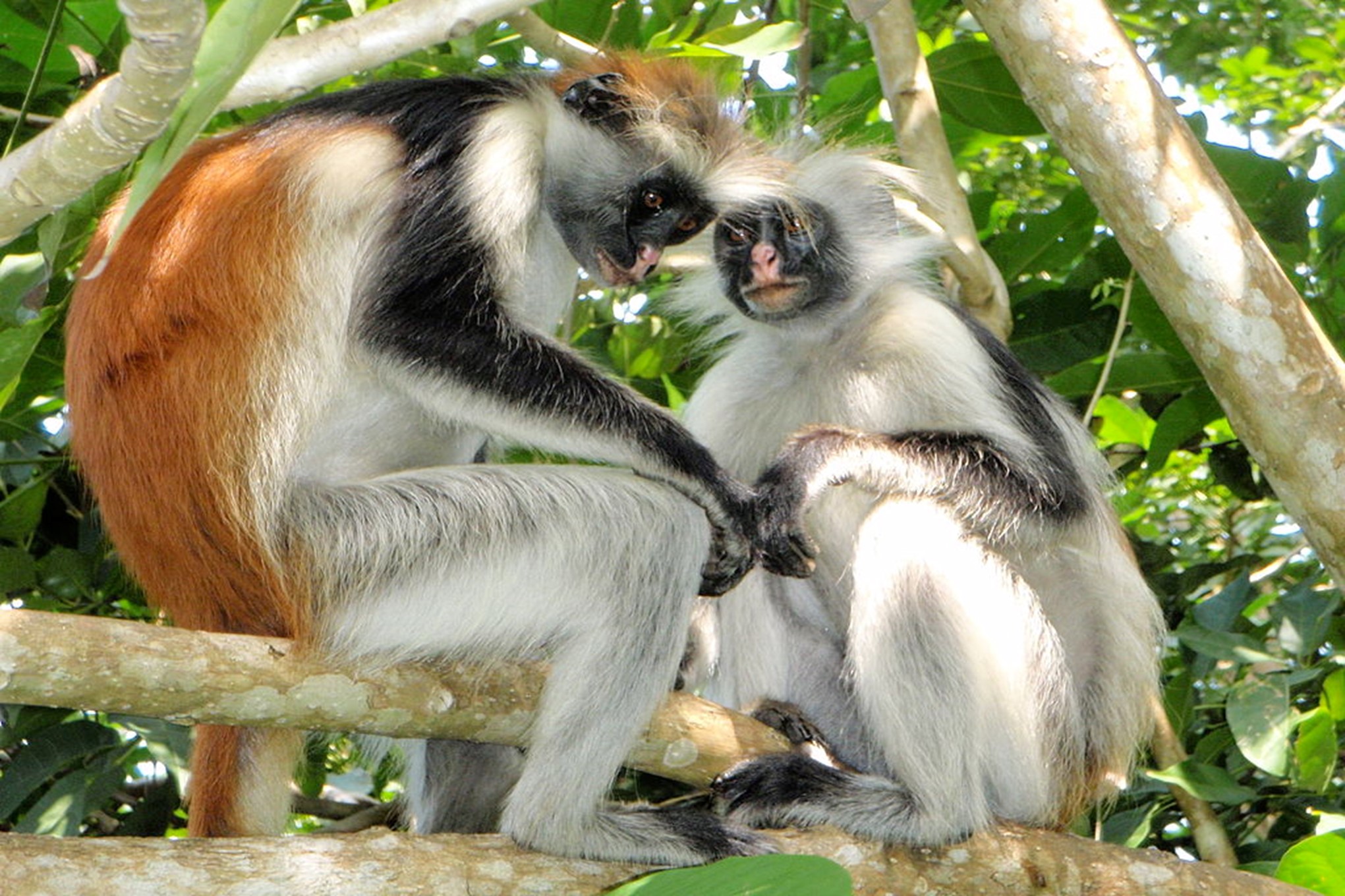
Zanzibar Red Colobus Monkeys: found only in Zanzibar
Apart from more than 40 species of birds, the forest is home to fantastic wildlife including:
- Aders's duiker: only found in Zanzibar and Kenya - Zanzibar servaline genet: found only in Zanzibar - Zanzibar leopard
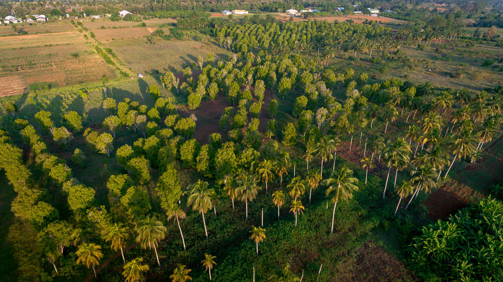
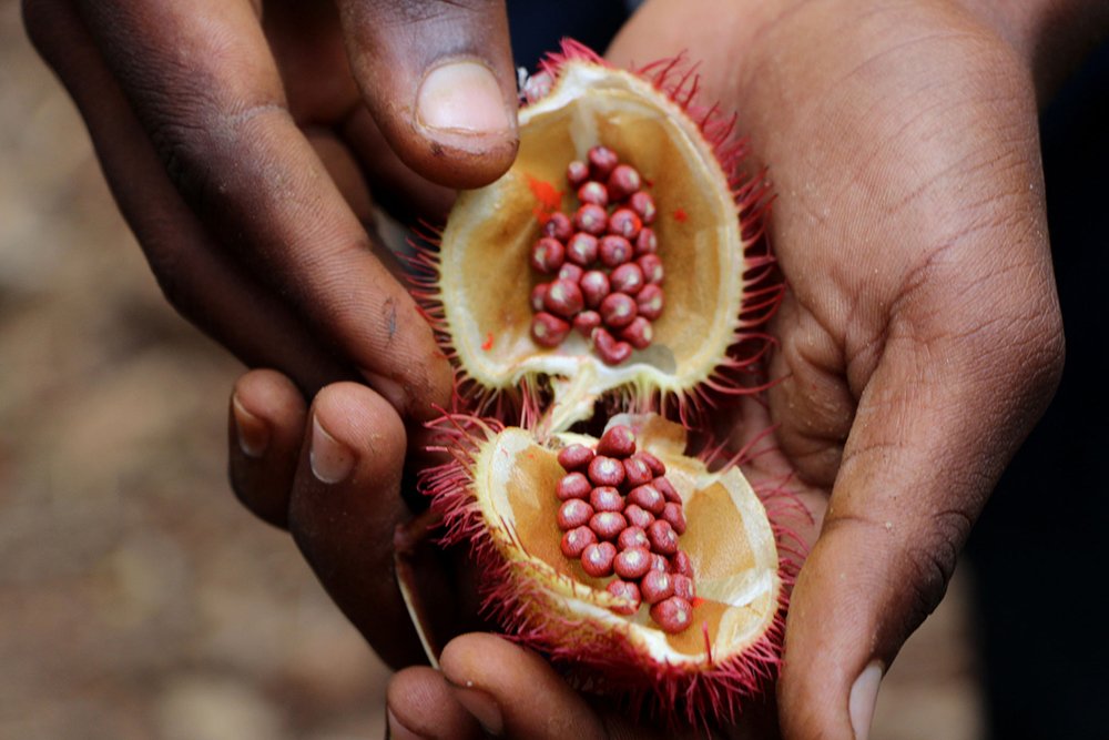
C: Spice Farm
The spice farms originate from Zanzibar historic position as “spice islands”. The spice farms include the fusion of spices from Swahili people, Indian, Persian and Arabian.
A spice plantation in Zanzibar
Although the spice exportation has a diminished role in recent years, it is still one of the major economic activities in Zanzibar.
Zanzibar Spice Farm tour
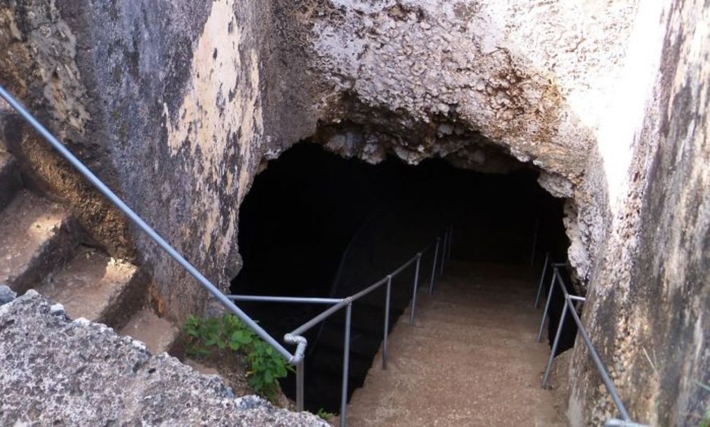
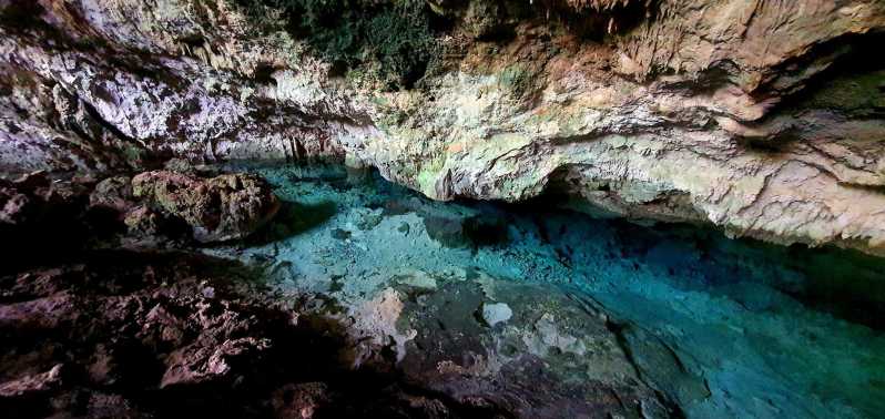
D: Mangapwani caves
The coral caves are one of the major historic and tourist attractions in Zanzibar. The Coral Cave is a profound natural cavern in the coralline rock with a thin passageway and a pool of freshwater which is situated at the lowest level. Water was presumably gathered from here by early occupants of the area.
Mangapwani caves
The caves are close to Mangapwani Slave Chambers built around 1880 from the cave and connected to the seaside 2kms away. It was an important transit point for the captured slaves to be sold to the outside world at the time of the abolishment of slavery in 1873 especial in the middle East. Between 1880-1905, the Slave chamber was being used as a place of concealment of the human cargo pending their disposal.
Mangapwani caves
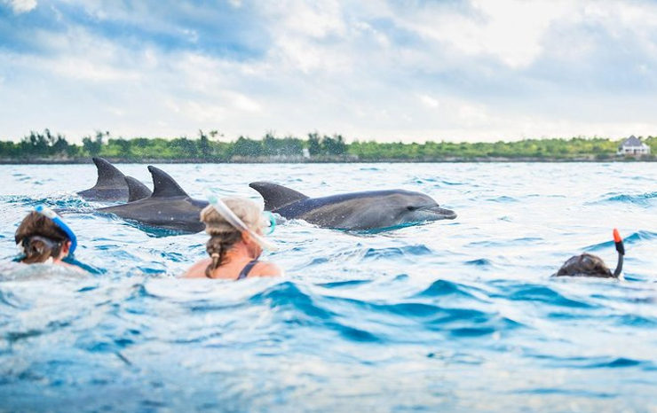
E: Kizimkazi Dolphin View
This half a day to full-day tour is one of the most exciting and adventurous tour for Zanzibar visitors. This tour will enable the visitors to experience dolphins in their natural habitats and playful nature.
Swimming with Dolphins in Zanzibar
The brave visitors can even experience playing and swimming with dolphins.
F: Prison Island
Also known as Changuu Island, it is a 30-40 minutes journey via traditional wooden boats from Stone Town.
The island was used as a slave point and later a prison was built (hence the name) but not utilized. The once intended prison is now a beautiful resort.
The beautiful island with its white sand beach is also home to huge Aldabra turtles which were presented as a gift from the British Governor of Seychelles in the early 1900s.
Prison Island
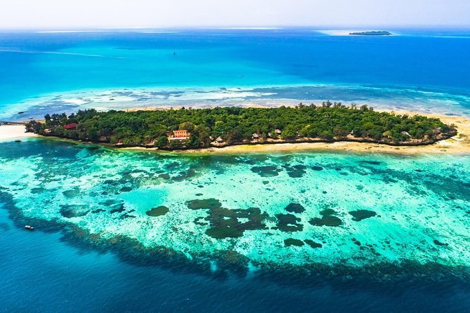
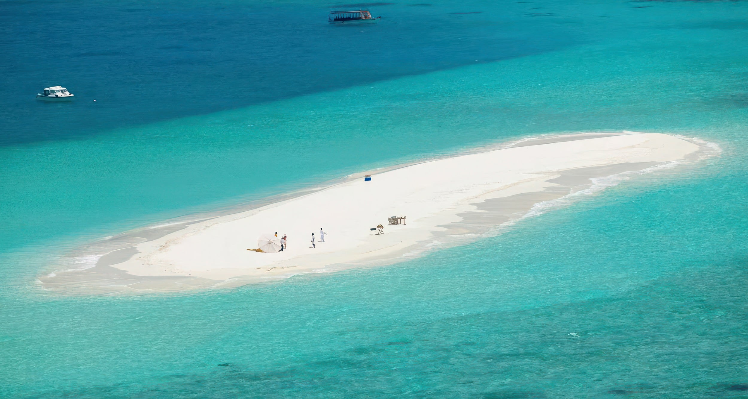
G: Safari Blue Tour
A program will start in the morning at 8:30 am, you will be picked from your hotel to Fumba village where you will meet your special boat special Guided safari blue tour Safari blue tour in Zanzibar is a full-day tour that starts and ends at your hotel.
Aerial view of sandbank near Fumba beach
Safari blue Zanzibar, A unique and exclusive experience with your own traditional dhow and crew, touring the beautiful waters & islands around Zanzibar. Bespoke activities, private seafood BBQ, all the trimmings, perfect for the bucket list special occasion Safari blue trip in Zanzibar is one among the best sea adventures on the Zanzibar Island, not only sailing along with the traditional dhow but also you can have snorkeling, swim, and relaxing on a white sandy beach on a sandbank.
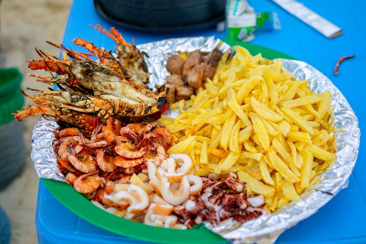
A sea food platter
In addition to all, there is plenty of seafood who are all waiting for you to be tested, the dhow departs from the Fumba beach at 09:30 am and we get back around 04:30 pm, with your Safari Blue guide, you will explore the mangrove lagoon hidden inside the Kwale Island. Between the snorkeling times, you can stay on the boats, taste fresh seasonal fruits, and end your trip with some fresh grilled seafood BBQ.
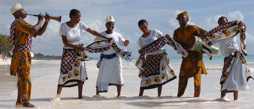
H: Zanzibar Culture Night
A display of the rich Zanzibar culture
Hospitality is deeply ingrained in the heart of Zanzibari culture. Upon arrival, visitors are embraced by warm smiles and open arms, making them feel instantly at home. A shared meal in a local household is an invitation to partake in the island’s sense of community, where traditional dishes like pilau, biryani, and freshly caught seafood are served with pride and love. This authentic dining experience is not merely a culinary adventure but a celebration of the Zanzibari way of life. The visit will include Zanzibar Cultural Night Event.
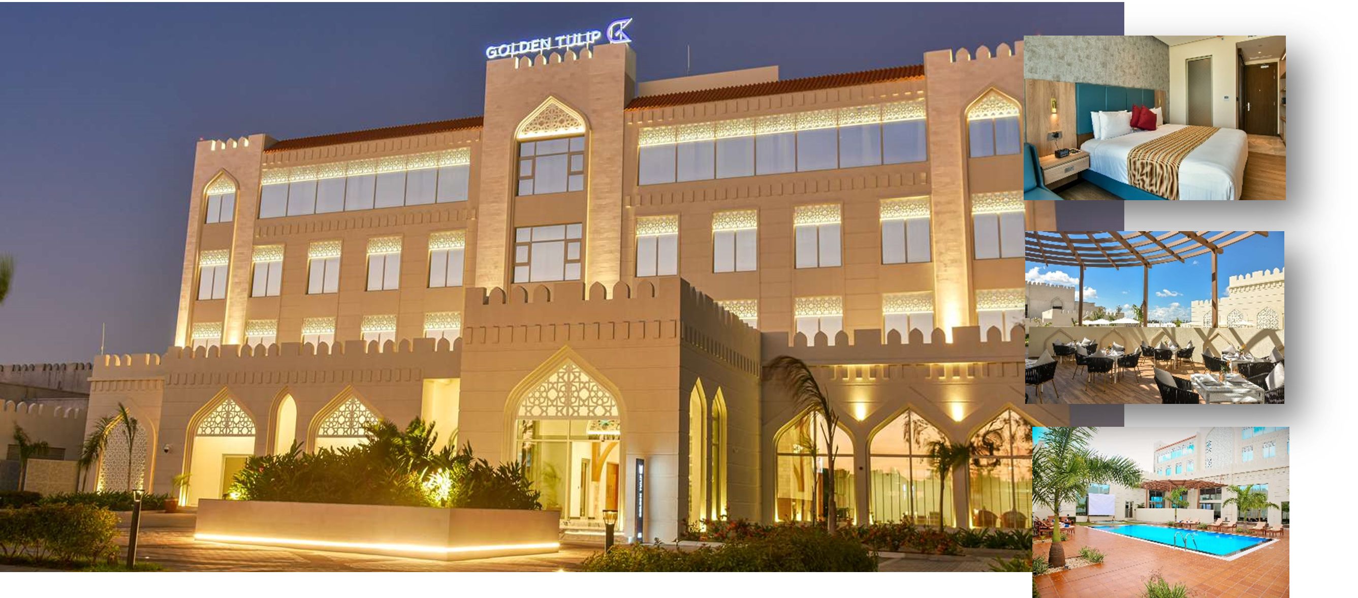
ACCOMMODATION
Delegates attending the field excursion will be hosted at the Golden Tulip Hotel, offering a comfortable and convenient stay throughout their visit. The hotel’s amenities and central location will ensure a seamless experience for all participants.
TRAVEL
Travel options from Dar es Salaam to Zanzibar include convenient flights with several airlines, offering quick and efficient transit.
Alternatively, delegates can opt for a scenic experience by taking a sea ferry, with VIP tickets recommended for added comfort and a memorable journey across the waters.
ZANZIBAR EXCURSION SCHEDULE
Day 1
Spice Tour
09:00 – 13:00Hrs Spice Tour 13:00 – 15:00Hrs Lunch at Hotel 15:00 – 16:00Hrs Rest time 16:00 – 18:00Hrs Visit to Forodhani Park 18:00Hrs Back to Hotel
Day 2
Option 1: Safari Blue Tour
08:00 – 12:00Hrs Safari Blue Tour 12:00 – 14:00Hrs Lunch at Changuu Island 14:00 – 16:00Hrs Swimming at Changuu Island 16:00Hrs Back to Hotel
Option 2: Kizimkazi Dolphin Tour
06:00 – 11:00Hrs Kizimkazi Dolphin Tour 11:00 – 12:00Hrs Jozani Forest Tour 12:00 – 14:00Hrs Lunch at Jozani Park 14:00 – 16:00Hrs Visit Jozani Park 16:00Hrs Back to Hotel
Day 3
Mangapwani Caves & Stone Town
09:00 – 11:00Hrs Mangapwani Caves 11:00 – 12:00Hrs Back to Stone Town 12:00 – 13:00Hrs Lunch at Stone Town 13:00 – 17:00Hrs City Tour and Shopping 15:00Hrs Back to Hotel
Fees: US$ 995
Includes meals, ground transport, accommodation and park entry fees.
Contact
Mr. Khamis Juma Khamis Manager Public Relations Unity Zanzibar Petroleum Regulatory Authority P.O.BOX 4647 Zanzibar Call: +255 777 452670 Email: This email address is being protected from spambots. You need JavaScript enabled to view it.
Upon arrival at Kigali International Airport, delegates will be welcomed and transferred to their designated hotel for an overnight stay in Kigali.
DAY 2: Kigali to Bugarama Geothermal Hotsprings
Delegates will depart early from Kigali, traveling southwest to visit the Bugarama Geothermal Hotsprings.
Bugarama, located 115 km from Kigali, showcases Rwanda’s hydrothermal activity, including hot springs and travertine deposits. Rwanda has an estimated potential of 100 MW of geothermal power, which represents a sustainable and eco-friendly energy resource. This potential can significantly lower the costs of electricity generation compared to current oil-based power sources.
After exploring the geothermal site, delegates will have lunch at the Mantis Kivu Marina Bay Hotel. Delegates will return to Kigali for an overnight stay, preparing for the next day’s excursion.
hot-springs
DAY 3: NYUNGWE NATIONAL PARK
On the way out of Nyungwe Forest, delegates will visit the famous Gisakura Tea Estate, to learn the art of picking tea leaves and sample fresh black tea grown in the local area.
Isumo Falls
Fees: US$850 per person
Cost- will cover local transport, meals and access to excursion venues
Contact information:
Solange Barambonye Petroleum Engineer, Rwanda Mines, Petroleum and Gas Board E-mail: This email address is being protected from spambots. You need JavaScript enabled to view it. Cell-phone: +250783366157